 Rapid is a geophysical
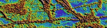
  Acquisition Project Management for Ground, Marine and Airborne magnetics and gradient surveys. Processing of Magnetic data, grid merging and mosaicing. Fourier derivative generation, inversion and interpretation.
 Acquisition Project Management for Ground, Marine and Airborne gravity and gradiometry surveys. Processing of Gravity data, grid merging and mosaicing. Fourier derivative generation, inversion and interpretation.
 Acquisition Project Management for Ground, Marine, Airborne and Borehole survey design. Processing of Electromagnetic CDI construction and quality control. Interpretation of Ground, Airborne and Borehole discrete plate modelling.
 Acquisition Project Management for Ground and Airborne Radiometric surveys. Processing of Radiometric data, grid merging and mosaicing, grid ratio and derivative generation. Radiometric Principle Component Analysis and image processing, Structural Interpretation and anomaly picking, ranking and drill hole planning.
 Interpretation of Landsat and ASTER data, grid merging and mosaicing, Principle Component Analysis and image processing, Structural Interpretation, Clay ratio and Iron oxide image processing, SRTM re-gridding to remove nulls and artifacts.
 0
0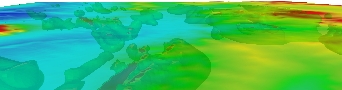 1
1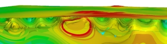 2
2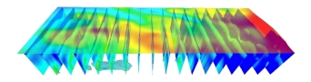 3
3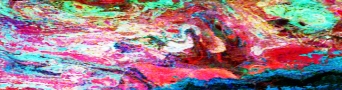 4
4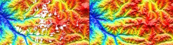 5
5
Cameron Exploration:
Cameron Exploration uses the expertise of Rapid Geophysics to implement strategy for agricultural and salinity management processes.
Geoelectric surveying and 3D water management modelling are focus areas for CAMEX with the intent to offer high quality geophysical interpretations tailored for water management objectives.
Please navigate the tabs presented in the main sub-menu list above to learn more about CAMEX.
Cameron Exploration Contact Details:
Rob Cameron
Director
+61 (0) 451 944 877
rob@cameronexploration.com.au
www.cameronexploration.com.au
Rapid Geophysics Contact Details:
Barrett Cameron
Managing Director - Geophysicist
+61 (0) 403 108 977
b.cameron@rapidgeophysics.com.au

