 Rapid is a geophysical
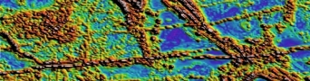
  Acquisition Project Management for Ground, Marine and Airborne magnetics and gradient surveys. Processing of Magnetic data, grid merging and mosaicing. Fourier derivative generation, inversion and interpretation.
 Acquisition Project Management for Ground, Marine and Airborne gravity and gradiometry surveys. Processing of Gravity data, grid merging and mosaicing. Fourier derivative generation, inversion and interpretation.
 Acquisition Project Management for Ground, Marine, Airborne and Borehole survey design. Processing of Electromagnetic CDI construction and quality control. Interpretation of Ground, Airborne and Borehole discrete plate modelling.
 Acquisition Project Management for Ground and Airborne Radiometric surveys. Processing of Radiometric data, grid merging and mosaicing, grid ratio and derivative generation. Radiometric Principle Component Analysis and image processing, Structural Interpretation and anomaly picking, ranking and drill hole planning.
 Interpretation of Landsat and ASTER data, grid merging and mosaicing, Principle Component Analysis and image processing, Structural Interpretation, Clay ratio and Iron oxide image processing, SRTM re-gridding to remove nulls and artifacts.
 0
0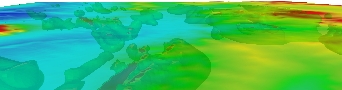 1
1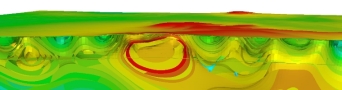 2
2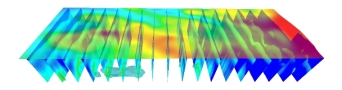 3
3 4
4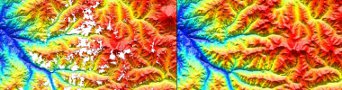 5
5Ground Water Models:
Overview:
- We use groundwater models to simulate and predict aquifer conditions providing an understanding of the natural groundwater flow in the environment.
- Our accurate geoelectric data allows us to model real world situations to provide you with the factors that influence groundwater.
- This can assist you in planning strategies to manage salinity, waterlogging, drainage channels, placement of bores, aquaculture, irrigation and farm water management.

Image Source: http://en.m.wikipedia.org/wiki/Groundwater_models
